Adding Elevation Lines to a Map
Terrain Modeling Module (TMM) can overlay one or more sets of elevation lines on your display, covering all or part of the network extent. The elevation information comes from an elevation map file, which TMM creates from the terrain data files.
Procedure 9: Displaying Elevation Lines On A Map
-
Choose Topology > Terrain > Set Elevation Maps.
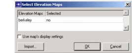
The Select Elevation Maps dialog box opens, with a list of elevation map files that have previously been created.
-
Click in the Selected column next to the name of each elevation map you want to display.
-
Click OK.
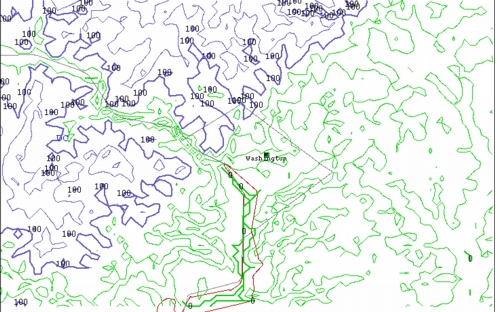
The elevation lines are drawn on the map.
Note: This operation may take a minute or more if the elevation map file contains a lot of data.
Figure 11: Map with Elevation Lines
New Elevation Map Files
If you want to display elevation lines that aren’t in an existing map, you can create a new map by clicking the Import button.
For more information, see Generating an Elevation Map File.
Map Display Settings
The Use Map’s Display Settings checkbox specifies whether the display settings saved in the selected elevation map file will be used in place of the current display settings. When checked, this option uses the colors and line detail defined in the map file.
For more information about display settings, see Configuring the Display of Elevation Lines.