3D Network Visualizer Features
3D Network Visualizer delivers a realistic, three-dimensional view of terrain, vehicles, and other objects. 3D Network Visualizer's navigation controls give you complete freedom to travel anywhere as an unobtrusive observer. You can place the observer at a specific location, or link it to a vehicle for automatic tracking of battlefield activities. While an exercise is underway, you can switch attach modes quickly to see the scene from any perspective. 3D Network Visualizer can be visible to other applications or invisible, at your discretion.
Figure 42: 3D Network Visualizer
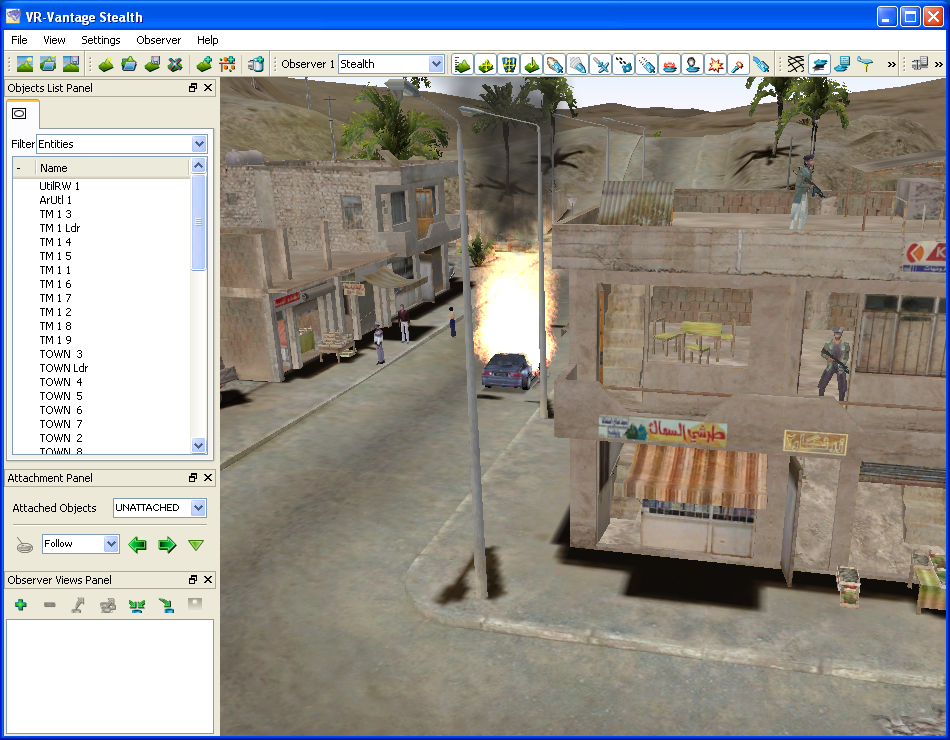
The 3D Network Visualizer provides a range of features that make it an essential tool during any phase of a High Level Architecture (HLA) project.
Support for HLA
You can connect and disconnect from simulations during runtime and can configure the connections in the graphical user interface (GUI). 3D Network Visualizer supports the following simulation network protocols:
- HLA 1.3 and 1516. 3D Network Visualizer supports the HLA 1.3 specification and the current draft of the IEEE 1516 C++ API maintained by the SISO Dynamic Link Compatible RTI API Product Development Group. It has built-in support for the HLA RPR FOM and can support other FOMs through the FOM Mapping feature.
Realistic Display of Vehicles and Terrain
3D Network Visualizer provides a realistic display using terrain and moving-model geometry in the OpenFlight format. It includes many 3D vehicle models, some of which display movement of articulated parts, such as turrets and rotors. These models can change to show a damaged or destroyed state. You can provide your own models and map them to entity types. For details about terrain, please see Chapter 11 “Composing Terrains” on page 143. For details about models, please see Chapter 21 “Mapping Models and Effects” on page 315.
3D Network Visualizer also displays:
- Smoking and flaming effects
- Trailing effects
- Muzzle flashes
- Track histories
- Explosions
3D Network Visualizer presents terrain realistically, and lets you control visibility, time-of-day, and other effects. For details, please see Chapter 13 “Scenes and Environmental Effects” on page 203.
Multiple Attach Modes
3D Network Visualizer offers attach modes that let you:
- Manually control the observer's position and orientation.
- Follow an entity, maintaining a consistent positional offset, with a matching heading.
- Mimic a vehicle's position and orientation. You can place the observer inside the vehicle for a driver's-eye view, or fly outside of it, moving in tandem with the vehicle.
- Tether the observer to an entity, maintaining a consistent positional offset without changing the observer's heading.
- Automatically track a vehicle's movement from a fixed viewpoint, as if watching from a control tower.
For more information, please see Chapter 15 “Moving the Observer” on page 221.
Accurate Vehicle Positioning
3D Network Visualizer can smooth the trajectories of moving vehicles to compensate for discontinuous positional data. The ground clamping feature can ensure that all ground entities are placed correctly on the terrain surface. For details, please see “Trajectory Smoothing“ on page 268 and “Using Ground Clamping“ on page 266.
eXaggerated Reality (XR)
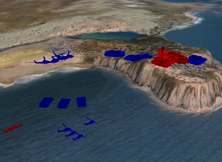
3D Network Visualizer XR supports all of the 3D features of 3D Network Visualizer. Then it adds the XR model set to enhance your ability to understand the layout of forces in the 3D projection. The notional icons are scaled to be visible regardless of the observer's distance from the entities. You can resize the icons to ensure that you have the right view for your needs. For more information, please see Chapter 20 “Using 3D Network Visualizer XR” on page 305.
Figure 43: Model scaling and colorized models
Terrain Agility and Composability
3D Network Visualizer allows you to build your terrain at runtime using a variety of database and vector formats. It can load OpenFlight DTED, CTDB, MetaFlight, and GDB (MÄK terrain format) databases. It can load feature data from shapefiles and GDB files. You can also superimpose geospatial images such as GeoTiffs or other raster image files on the terrain. You can save these composed terrains in the 3D Network Visualizer MTF file format.
For details, please see Chapter 11 “Composing Terrains” on page 143.
Remote Control
You can control 3D Network Visualizer remotely through view control messages, which can be generated by Riverbed applications such as the Logger.
For details, please see “Controlling the Observer from Other Applications“ on page 241.
Flexible, Intuitive Graphical User Interface
3D Network Visualizer's graphical user interface (GUI) allows you to manipulate 3D Network Visualizer from menus, dockable control panels, and the keyboard.
You can hide and display the control panels, keep them docked to the screen, or undock them to make more space available for the display window. The GUI controls can be hidden for full-screen demonstrations.